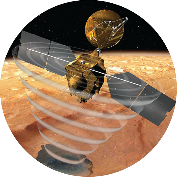
I serve as a science team member for the Shallow Radar (SHARAD) onboard the Mars Reconnaissance Orbitor (MRO)
I serve as Systems Manager for the Colorado SHARAD Processing System

A NASA funded Planetary Data Archival, Restoration, and Tools (PDART) project developing a stand-alone web-application for planetary orbital radar sounder data processing, modeling, and visualization.
A NASA-funded Planetary Data Archival, Restoration, and Tools (PDART) project producing high-resolution 3D images of the polar caps of Mars using SHARAD observations.
A NASA-funded Planetary Data Archival, Restoration, and Tools (PDART) project producing 3D images of the polar caps of Mars using Mars Explorer (MEX) Mars Advanced Radar for Subsurface and Ionospheric Sounding (MARSIS) observations.

An effort to support NASA's Mars Exploration Program in identifying the location and nature of potential water resources on Mars.
A NASA-funded Mars Data Analysis Program (MDAP) project out of the Universtity of Texas at Austin using statistics of radar returns to understand and characterize the near-subsurface of Mars.
A NASA early-career fellowship focused on determining the feasibility and development of an autonomous roving exploration sytem (ARES) capable of characterizing local planetary subsurface environments quickly and efficiently with minimal human interaction
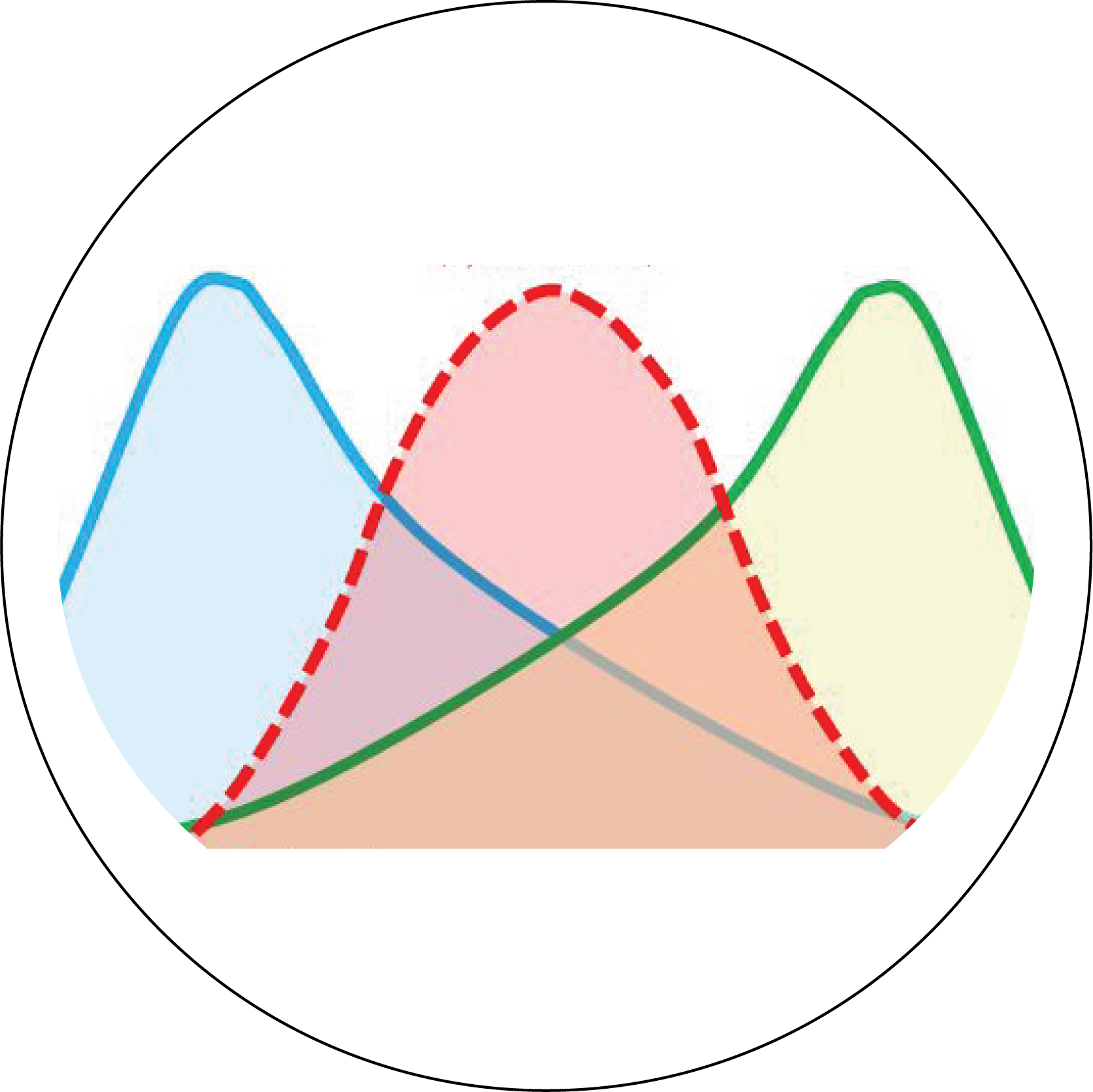
Rows expand to reveal article abstract.
Click the article title to open the publication in a new tab.
| Title | Authors | Journal | Date |
|---|---|---|---|
| Book Chapter: Ice Resource Mapping on Mars | Putzig and Morgan et al. | Handbook of Space Resources | April 2023 |
AbstractThis chapter describes the rationale for considering shallowly buried (0 -> 5 m depth) water ice in the mid-latitude of Mars as a resource to support future human missions, and it describes a NASA-funded effort to map that ice with existing orbital remote-sensing data. In recent decades, numerous studies have used various data sets to investigate the presence and stability of water ice in the Martian shallow subsurface, with a view toward understanding the planet's recent climate history. As part of a renewed effort to prepare for human Mars missions, NASA has undertaken a more resource-focused approach. Here we describe the Mars Subsurface Water Ice Mapping (SWIM) Team's efforts to characterize the distribution of buried water ice resources across all longitudes from 60ºS to 60ºN latitude through the integration of multiple data sets. Deriving composite measures for the presence of accessible ice from a diverse range of remote sensing techniques with unique resolutions and caveats is a challenging problem. To enable data synthesis, the team developed a methodology that assigns values of ice consistency for mapped detections of hydrogen from a neutron spectrometer, thermal behavior from various thermal spectrometers, multiscale geomorphology from imagery and elevation data, and surface and subsurface echoes from a radar sounder. Faced with diverse sensing depths and footprints for these datasets, the team has been pursuing an optimal approach to best represent multi-dataset ice consistency. The current formulation includes the use of weighting factors tuned to depth zones of interest for resource extraction. In the absence of dedicated ground truth data, the validity of the team's efforts is assessed by comparing the maps to the locations of fresh, ice-exposing impacts. The highest ice-consistency values occur within discrete zones poleward of ~40º latitude, where ice is relatively shallow, but positive values extend well into the ~20-30º latitude zone, which is preferable for landing sites due to engineering considerations |
|||
| New Views of the Internal Structure of Planum Boreum from Enhanced 3D Imaging of Mars Reconnaissance Orbiter Shallow Radar Data | Putzig et al. | The Planetary Science Journal | November 2022 |
AbstractWe present first results from a new 3D radargram produced from 3399 Mars Reconnaissance Orbiter (MRO) Shallow Radar observations of the north polar region of Mars. While incorporating an additional 5 yr of observations relative to the prior 3D radargram, we employed surface-clutter simulations to improve the coregistration of the input data and thereby enhance the effective vertical resolution of features. Combining those improvements with the geometric corrections and an increase in signal-to-noise ratio afforded by the 3D imaging process, this data product provides new details about the interior of Planum Boreum, the Martian north polar cap. We assess the overall characteristics and compare portions of the new 3D radargram to results from prior studies that used either the prior 3D radargram or sets of 2D radargrams from individual MRO orbits. We find that the new 3D radargram has recovered essentially all of the vertical resolution inherent to the input data, and the increased coverage density has substantially reduced artifacts while enabling much greater detail in the imaging of subsurface layering and structures. These improvements extend throughout the 3D radargram, from the basal units to the shallowest subsurface layering in Planum Boreum, and out into the surrounding plains. Subsurface features such as a buried chasma, other layering structures and unconformities, and trough-bounding surfaces that offset shallow layering are now visible in unprecedented detail. A thorough analysis of this new 3D radargram and its implications for the geologic and climate history of Planum Boreum will extend over many years. |
|||
| Investigating the Martian Surface at Decametric Scale: Population, Distribution, and Dimension of Heterogeneity from Radar Statistics | Grima et al. | The Planetary Science Journal | October 2022 |
AbstractBuilding on one decade of theory and methodology maturation, we investigate the coherent and incoherent components of the response of the Martian surface to nadir-looking orbital radar. We apply a reflectometry technique known as radar statistical reconnaissance to Mars Reconnaissance Orbiter Shallow Radar data over a test region with a large dynamic range in echo strength. This technique provides a set of statistical parameters describing the heterogeneity of the surface and near-surface structure, presumably at a scale of ~15 m. We discuss the physical meanings of these parameters related to surface and near-surface properties. Most (but not all) investigated terrains have a dominantly coherent surface return, a characteristic that is not necessarily indicative of a smooth surface. The observed behavior of the coherent and incoherent power components of the echo matches signal growth with increasing surface roughness. This finding allows us to identify smooth and level terrains that we use as a reference to approximate the surface height and slope variations of other regions. Nearly systematic mismatches between the SHARAD and MOLA-pulse-width roughness illustrate the complementarity of these data sets from their respective sensitivity range, and advocate for the use of self-affine radar backscattering models to account for roughness variations at different scales. Our methodology provides a wealth of surface properties assessment based on radar scattering with quasi-global coverage, without a dependence on other data, and at a decametric horizontal scale relevant to subregional geology investigation and landing site reconnaissance. |
|||
| The Impact of Energetic Particles on the Martian Ionosphere During a Full Solar Cycle of Radar Observations: Radar Blackouts | Lester et al. | Journal of Geophysical Research: Space Physics | January 2022 |
AbstractWe present the first long-term characterization of ionization layers in the lower ionosphere of Mars (below ~90 km), a region inaccessible to orbital in-situ observations, based on an analysis of radar echo blackouts observed on Mars Express and the Mars Reconnaissance Orbiter from 2006 to 2017. A blackout occurs when the expected surface reflection is partly or totally attenuated for portions of an observation. Enhanced ionization at altitudes of 60-90 km, below the main ionospheric electron density peak, leads to increased absorption of the radar signal, resulting in the blackouts. We find that (a) MARSIS, operating at frequencies between 1.8 and 5 MHz, suffered more blackouts than SHARAD, which has a higher carrier frequency (20 MHz), (b) there is a clear correlation of blackout occurrence with solar cycle, (c) there is no apparent relationship between blackout occurrence and crustal magnetic fields, and (d) blackouts occur during both nightside and dayside observations, although the peak occurrence is deep on the nightside. Analysis of Mars Atmosphere and Volatile EvolutioN Solar Energetic Particle electron counts between 20 and 200 keV demonstrates that these electrons are likely responsible for attenuating the radar signals. We investigate the minimum SEP electron fluxes required to ionize the lower atmosphere and produce measurable attenuation. When both radars experience a blackout, the SEP electron fluxes are at their highest. Based on several case studies, we find that the average SEP spectrum responsible for a blackout is particularly enhanced at its higher energy end, that is, above 70 keV. |
|||
| Solar-System-Wide Significance of Mars Polar Science | Smith et al. | Bulletin of the American Astronomical Society | March 2021 |
AbstractMars Polar Science is an integrated, compelling system that serves as a nearby analogue to numerous other planets, supports human exploration, and habitability. Mars possesses the closest and most easily accessible layered ice deposits outside of Earth, and accessing those layers to read the climate record would be a triumph for planetary science. |
|||
| Mid-Latitude Ice on Mars: A Science Target for Planetary Climate Histories and an Exploration Target for In Situ Resources | Bramson et al. | Bulletin of the American Astronomical Society | March 2021 |
AbstractWhat climate record is preserved in mid-latitude water ice deposits on Mars? How accessible is the ice as a resource for future exploration? New missions are required to address the dearth of data capable of resolving the upper tens of meters of the Martian subsurface in order to answer there, and additional, questions about Mars' mid-latitude ice. |
|||
| Developing Active Source Seismology for Planetary Science | Courville et al. | Bulletin of the American Astronomical Society | March 2021 |
AbstractThe development of active-source seismology instrumentation to survey subsurface habitability, geology, and water ice has lagged behind other geophysical techniques. We recommend that the Planetary Decadal Survey place the development and maturation of instrumentation for active-source seismology as a high priority for the coming decade. |
|||
| Availability of subsurface water-ice resources in the northern mid-latitudes of Mars | Morgan et al. | Nature Astronomy | February 2021 |
AbstractMultiple nations and private entities are pushing to make landing humans on Mars a reality. The majority of proposed mission architectures envision ‘living off the land’ by leveraging Martian water-ice deposits for fuel production and other purposes. Fortunately for mission designers, water ice exists on Mars in plentiful volumes. The challenge is isolating accessible ice deposits within regions that optimize other preferred landing-site conditions. Here we present the first results of the Mars Subsurface Water Ice Mapping (SWIM) project, which has the aim of searching for buried ice resources across the mid-latitudes. Through the integration of orbital datasets in concert with new data-processing techniques, the SWIM project assesses the likelihood of ice by quantifying the consistency of multiple, independent data sources with the presence of ice. Concentrating our efforts across the majority of the northern hemisphere, our composite ice-consistency maps indicate that the broad plains of Arcadia and the extensive glacial networks across Deuteronilus Mensae match the greatest number of remote-sensing criteria for accessible ice-rich, subsurface material situated equatorwards of the contemporary ice-stability zone. |
|||
| Lower Bounds on the Thickness and Dust Content of Layers within the North Polar Layered Deposits of Mars from Radar Forward Modeling | Courville et al. | The Planetary Science Journal | February 2021 |
AbstractThe Mars Reconnaissance Orbiter's Shallow Radar (SHARAD) emits radar signals and records their reflections from layer boundaries within the Martian north polar ice cap. Previous studies have suggested that the ice cap is composed of thin dust-rich layers between thicker layers of nearly pure water ice. The prevailing hypotheses suggest that each dust-rich layer represents either a period of ice sublimation at the poles or a period of reduced ice deposition relative to dust deposition. To test whether thin dust beds are a plausible hypothesis for the observed SHARAD reflectors, we use RadSPy (radar sounding simulator in Python), an open-source N-layer radar sounder forward-modeling software that we have developed and describe herein. We forward model radar data from thin dust-rich beds interspersing pure ice, and compare them to observed radar reflection data over Gemina Lingula in the north polar layered deposits (NPLD). We consider two end-member cases: (1) thin beds composed entirely of dust, but with thickness varying from 0.05 m to 0.4 m; and (2) dust beds all with the same thickness, but with varying dust content. We find that the observed reflections can be explained by either scenario, i.e., varying thickness or varying dust content, and we conclude that a combination of both is likely. More importantly, our results provide lower bounds on the layer thickness and dust fraction for the flat-lying reflectors of Gemina Lingula in the NPLD. Our findings support the thin dust layer hypothesis, providing new constraints on layer composition and geometry for Mars climate researchers. |
|||
| The Holy Grail: A road map for unlocking the climate record stored within Mars’ polar layered deposits | Smith et al. | Planetary and Space Science | May 2020 |
Abstract
In its polar layered deposits (PLD), Mars possesses a record of its recent climate, analogous to terrestrial ice sheets containing climate records on Earth. Each PLD is greater than 2 km thick and contains thousands of layers, each containing information on the climatic and atmospheric state during its deposition, creating a climate archive. With detailed measurements of layer composition, it may be possible to extract age, accumulation rates, atmospheric conditions, and surface activity at the time of deposition, among other important parameters; gaining the information would allow us to “read” the climate record. Because Mars has fewer complicating factors than Earth (e.g. oceans, biology, and human-modified climate), the planet offers a unique opportunity to study the history of a terrestrial planet’s climate, which in turn can teach us about our own planet and the thousands of terrestrial exoplanets waiting to be discovered. |
|||
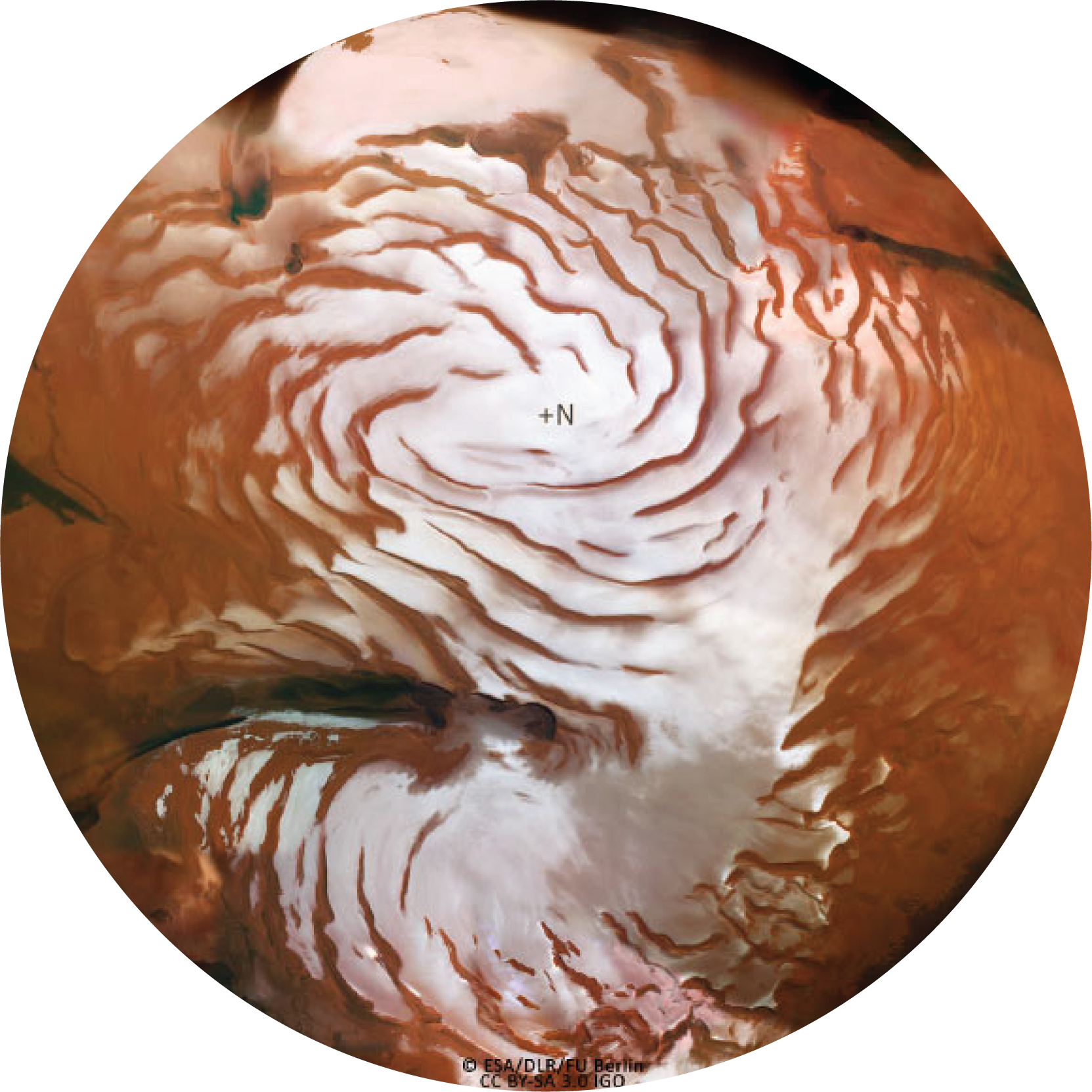
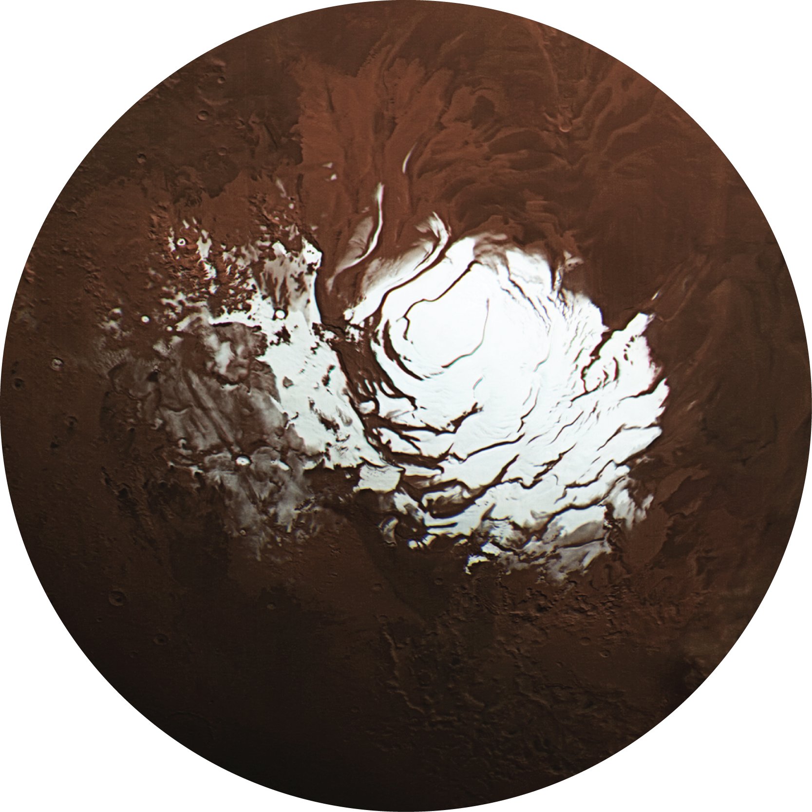
| Three-dimensional radar imaging of structures and craters in the Martian polar caps | Putzig et al. | Icarus | July 2018 |
AbstractOver the last decade, observations acquired by the Shallow Radar (SHARAD) sounder on individual passes of the Mars Reconnaissance Orbiter have revealed the internal structure of the Martian polar caps and provided new insights into the formation of the icy layers within and their relationship to climate. However, a complete picture of the cap interiors has been hampered by interfering reflections from off-nadir surface features and signal losses associated with sloping structures and scattering. Foss et al. (The Leading Edge 36, 43–57, 2017, https://doi.org/10.1190/tle36010043.1) addressed these limitations by assembling three-dimensional data volumes of SHARAD observations from thousands of orbital passes over each polar region and applying geometric corrections simultaneously. The radar volumes provide unprecedented views of subsurface features, readily imaging structures previously inferred from time-intensive manual analysis of single-orbit data (e.g., trough-bounding surfaces, a buried chasma, and a basal unit in the north, massive carbon-dioxide ice deposits and discontinuous layered sequences in the south). Our new mapping of the carbon-dioxide deposits yields a volume of 16,500 km3, 11% larger than the prior estimate. In addition, the radar volumes newly reveal other structures, including what appear to be buried impact craters with no surface expression. Our first assessment of 21 apparent craters at the base of the north polar layered deposits suggests a Hesperian age for the substrate, consistent with that of the surrounding plains as determined from statistics of surface cratering rates. Planned mapping of similar features throughout both polar volumes may provide new constraints on the age of the icy layered deposits. The radar volumes also provide new topographic data between the highest latitudes observed by the Mars Orbiter Laser Altimeter and those observed by SHARAD. In general, mapping of features in these radar volumes is placing new constraints on the nature and evolution of the polar deposits and associated climate changes. |
|||
| Limiting the effects of earthquakes on gravitational-wave interferometers | Coughlin et al. | Classical and Quantum Gravity | February 2017 |
AbstractGround-based gravitational wave interferometers such as the Laser Interferometer Gravitational-wave Observatory (LIGO) are susceptible to ground shaking from high-magnitude teleseismic events, which can interrupt their operation in science mode and significantly reduce their duty cycle. It can take several hours for a detector to stabilize enough to return to its nominal state for scientific observations. The down time can be reduced if advance warning of impending shaking is received and the impact is suppressed in the isolation system with the goal of maintaining stable operation even at the expense of increased instrumental noise. Here, we describe an early warning system for modern gravitational-wave observatories. The system relies on near real-time earthquake alerts provided by the U.S. Geological Survey (USGS) and the National Oceanic and Atmospheric Administration (NOAA). Preliminary low latency hypocenter and magnitude information is generally available in 5 to 20 min of a significant earthquake depending on its magnitude and location. The alerts are used to estimate arrival times and ground velocities at the gravitational-wave detectors. In general, 90% of the predictions for ground-motion amplitude are within a factor of 5 of measured values. The error in both arrival time and ground-motion prediction introduced by using preliminary, rather than final, hypocenter and magnitude information is minimal. By using a machine learning algorithm, we develop a prediction model that calculates the probability that a given earthquake will prevent a detector from taking data. Our initial results indicate that by using detector control configuration changes, we could prevent interruption of operation from 40 to 100 earthquake events in a 6-month time-period. |
|||
| Modeled temperatures and fluid source distributions for the Mexican subduction zone: Effects of hydrothermal circulation and implications for plate boundary seismic processes | Perry et al. | Geochemistry, Geophysics, Geosystems | February 2016 |
AbstractIn subduction zones, spatial variations in pore fluid pressure are hypothesized to control the sliding behavior of the plate boundary fault. The pressure-temperature paths for subducting material control the distributions of dehydration reactions, a primary control on the pore fluid pressure distribution. Thus, constraining subduction zone temperatures are required to understand the seismic processes along the plate interface. We present thermal models for three margin-perpendicular transects in the Mexican subduction zone. We examine the potential thermal effects of vigorous fluid circulation in a high-permeability aquifer within the basaltic basement of the oceanic crust and compare the results with models that invoke extremely high pore fluid pressures to reduce frictional heating along the megathrust. We combine thermal model results with petrological models to determine the spatial distribution of fluid release from the subducting slab and compare dewatering locations with the locations of seismicity, nonvolcanic tremor, slow-slip events, and low-frequency earthquakes. Simulations including hydrothermal circulation are most consistent with surface heat flux measurements. Hydrothermal circulation has a maximum cooling effect of 180°C. Hydrothermally cooled crust carries water deeper into the subduction zone; fluid release distributions in these models are most consistent with existing geophysical data. Our models predict focused fluid release, which could generate overpressures, coincident with an observed ultraslow layer (USL) and a region of nonvolcanic tremor. Landward of USLs, a downdip decrease in fluid source magnitude could result in the dissipation in overpressure in the oceanic crust without requiring a downdip increase in fault zone permeability, as posited in previous studies. |
|||
| The thermal effect of fluid circulation in the subducting crust on slab melting in the Chile subduction zone | Spinelli et al. | Earth and Planetary Science Letters | December 2015 |
AbstractFluids released from subducting slabs affect geochemical recycling and melt generation in the mantle wedge. The distribution of slab dehydration and the potential for slab melting are controlled by the composition/hydration of the slab entering a subduction zone and the pressure–temperature path that the slab follows. We examine the potential for along-strike changes in temperatures, fluid release, and slab melting for the subduction zone beneath the southern portion of the Southern Volcanic Zone (SVZ) in south central Chile. Because the age of the Nazca Plate entering the subduction zone decreases from ∼14 Ma north of the Guafo Fracture Zone to ∼6 Ma to the south, a southward warming of the subduction zone has been hypothesized. However, both north and south of Guafo Fracture Zone the geochemical signatures of southern SVZ arc lavas are similar, indicating 3–5 wt.% sediment melt and little to no contribution from melt of subducted basalt or aqueous fluids from subducted crust. We model temperatures in the system, use results of the thermal models and the thermodynamic calculation code Perple_X to estimate the pattern of dehydration-derived fluid release, and examine the potential locations for the onset of melting of the subducting slab. Surface heat flux observations in the region are most consistent with fluid circulation in the high permeability upper oceanic crust redistributing heat. This hydrothermal circulation preferentially cools the hottest parts of the system (i.e. those with the youngest subducting lithosphere). Models including the thermal effects of fluid circulation in the oceanic crust predict melting of the subducting sediment but not the basalt, consistent with the geochemical observations. In contrast, models that do not account for fluid circulation predict melting of both subducting sediment and basalt below the volcanic arc south of Guafo Fracture Zone. In our simulations with the effects of fluid circulation, the onset of sediment melting occurs under the volcanic arc, but dewatering of the subducting sediment and basalt is focused farther seaward (below the landward boundary of the stagnant mantle wedge corner). Thus, the sediment melt could enter the mantle wedge, contributing to the composition of the southern SVZ magmas, yet remain separate from the fluid derived from sediment dewatering which could migrate updip within the slab or into the wedge corner. Preferential hydrothermal cooling of the hottest segments of the system can help explain how there can be fairly uniform magma composition along the arc, despite large along-arc differences in the age of the subducting plate. |
|||
| DEM L241, a Supernova Remnant containing a High-Mass X-ray Binary | Seward et al. | The Astrophysical Journal | October 2012 |
AbstractA Chandra observation of the Large Magellanic Cloud supernova remnant DEM L241 reveals an interior unresolved source which is probably an accretion-powered binary. The optical counterpart is an O5III(f) star making this a high-mass X-ray binary with an orbital period likely to be of the order of tens of days. Emission from the remnant interior is thermal and spectral information is used to derive density and mass of the hot material. Elongation of the remnant is unusual and possible causes of this are discussed. The precursor star probably had mass >25 M☉ |
|||